space weather

the-twin-probes-just-launched-toward-mars-have-an-easter-egg-on-board

The twin probes just launched toward Mars have an Easter egg on board

The mission aims to aid our understanding of Mars’ climate history and what was behind the loss of its conditions that once supported liquid water, potential oceans, and possibly life on the surface.

Plaques and partner patches

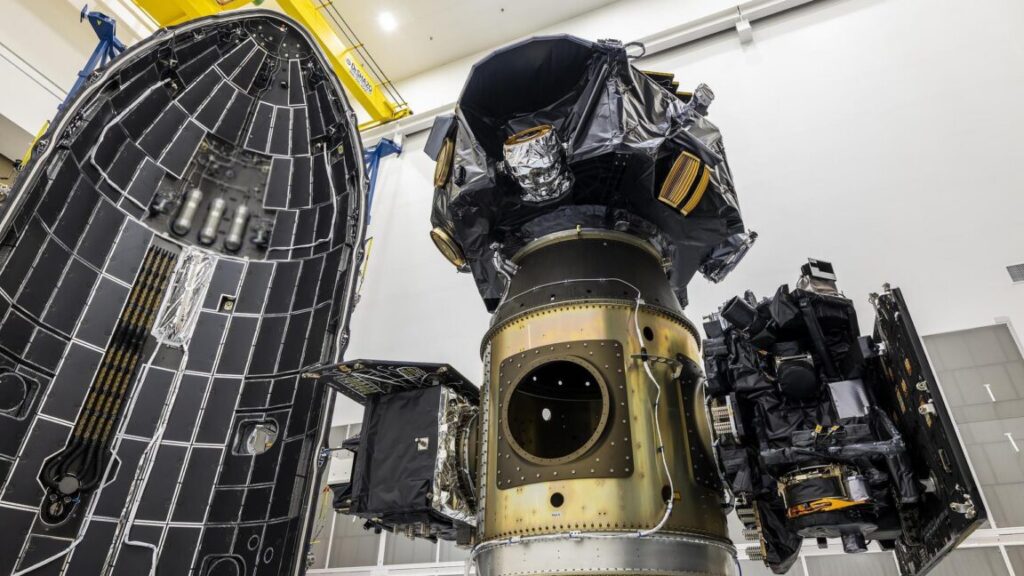
In addition to the kiwi-adorned plates, Rocket Lab also installed two more plaques on the twin ESCAPADE spacecraft.

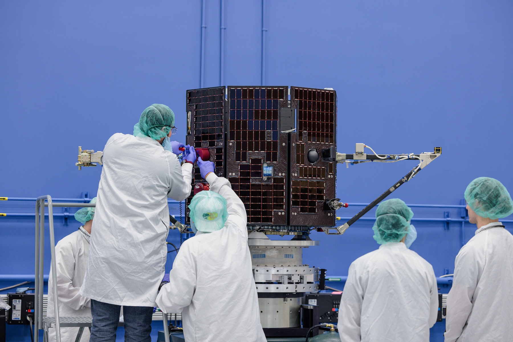
“There are also two name plates (one in blue and one in gold) on each spacecraft listing Rocket Lab team members who’ve contributed to the mission, making it possible to get to Mars,” said McLaurin.

Mounted on the solar panels, the plaques use shading to also display the Latin initials (NSHO) of the Rocket Lab motto and form the company’s logo. Despite their diminutive size, each plate appears to include more than 200 names, including founder, president, and CEO Peter Beck.

Montage of photos and graphics illustrating the blue and gold metal plates attached a spacecraft

Additional plates in blue and gold display the names of the Rocket Lab team members behind the ESCAPADE spacecraft. Credit: UCB-SSL via collectSPACE.com

UC Berkeley adopted its colors in 1873. According to the school’s website, “blue for the California sky and ocean and for the Yale graduates who helped establish the university, gold for the ‘Golden State.’”

ESCAPADE also has its own set of colors, or rather, colorful patches.

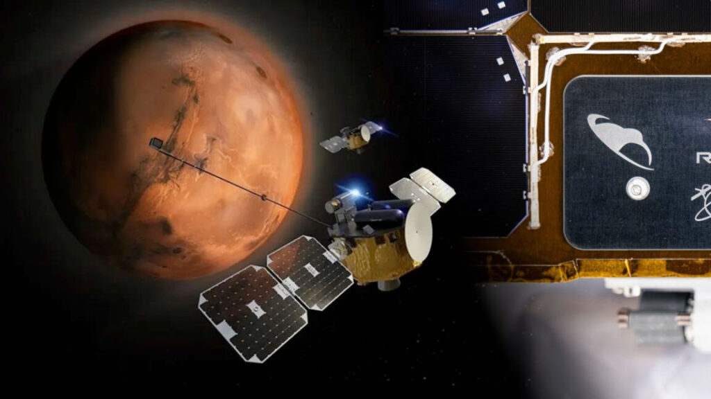
The main mission logo depicts the twin spacecraft in orbit around Mars with the names of the primary partners listed along its border, including UCB-SSL (University of California, Berkeley-Space Science Laboratory); RL (Rocket Lab); ERAU (Embry-Riddle Aeronautical University, which designed and built the langmuir probe, one of the mission’s science instruments); AdvSp (Advanced Space, which oversaw mission design and trajectory optimization); and NASA-GSFC (NASA Goddard Space Flight Center).

Rocket Lab also designed an insignia, which renders the two spacecraft in blue and gold, as well as shows their trajectory in the same colors and includes the company’s motto.

Lastly, Blue Origin’s New Glenn-2 (NG-2) patch features the launch vehicle and the two ESCAPADE satellites, using hues of orange to represent Mars.

Graphic montage of mission patches

Three mission patches represent the Mars ESCAPADE mission and its partners. Credit: NASA/Rocket Lab/Blue Origin/collectSPACE.com

The twin probes just launched toward Mars have an Easter egg on board Read More »

an-explosion-92-million-miles-away-just-grounded-jeff-bezos’-new-glenn-rocket

An explosion 92 million miles away just grounded Jeff Bezos’ New Glenn rocket

A series of eruptions from the Sun, known as coronal mass ejections, sparked dazzling auroral light shows Tuesday night. The eruptions sent a blast of material from the Sun, including charged particles with a strong localized magnetic field, toward the Earth at more than 1 million mph, or more than 500 kilometers per second.

A solar ultraviolet imager on one of NOAA’s GOES weather satellites captured this view of a coronal mass ejection from the Sun early Tuesday. Credit: NOAA

Satellites detected the most recent strong coronal mass ejection, accompanied by a bright solar flare, early Tuesday. It was expected to arrive at Earth on Wednesday.

“We’ve already had two of three anticipated coronal mass ejections arrive here at Earth,” said Shawn Dahl, a forecaster at NOAA’s Space Weather Prediction Center in Boulder, Colorado. The first two waves “packed quite a punch,” Dahl said, and were “profoundly stronger than we anticipated.”

The storm sparked northern lights that were visible as far south as Texas, Florida, and Mexico on Tuesday night. Another round of northern lights might be visible Wednesday night.

The storm arriving Wednesday was the “most energetic” of all the recent coronal mass ejections, Dahl said. It’s also traveling at higher speed, fast enough to cover the 92 million-mile gulf between the Sun and the Earth in less than two days. Forecasters predict a G4 level, or severe, geomagnetic storm Wednesday into Thursday, with a slight chance of a rarer extreme G5 storm, something that has only happened once in the last two decades.

The Aurora Borealis lights up the night sky over Monroe, Wisconsin, on November 11, 2025, during one of the strongest solar storms in decades. Credit: Ross Harried/NurPhoto via Getty Images

The sudden arrival of a rush of charged particles from the Sun can create disturbances in Earth’s magnetic field, affecting power grids, degrading GPS navigation signals, and disrupting radio communications. A G4 geomagnetic storm can trigger “possible widespread voltage control problems” in terrestrial electrical networks, according to NOAA, along with potential surface charging problems on satellites flying above the protective layers of the atmosphere.

It’s not easy to predict the precise impacts of a geomagnetic storm until it arrives on Earth’s doorstep. Several satellites positioned a million miles from Earth in the direction of the Sun carry sensors to detect the speed of the solar wind, its charge, and the direction of its magnetic field. This information helps forecasters know what to expect.

“These types of storms can be very variable,” Dahl said.

An explosion 92 million miles away just grounded Jeff Bezos’ New Glenn rocket Read More »

a-“cosmic-carpool”-is-traveling-to-a-distant-space-weather-observation-post

A “cosmic carpool” is traveling to a distant space weather observation post


“It’s like a bus. You wait for one and then three come at the same time.”

NASA’s IMAP spacecraft (top), the Carruthers Geocorona Observatory (left), and NOAA’s first operational space weather satellite (right) shared a ride to space on a Falcon 9 rocket Wednesday. Credit: SpaceX

Scientists loaded three missions worth nearly $1.6 billion on a SpaceX Falcon 9 rocket for launch Wednesday, toward an orbit nearly a million miles from Earth, to measure the supersonic stream of charged particles emanating from the Sun.

One of the missions, from the National Oceanic and Atmospheric Administration (NOAA), will beam back real-time observations of the solar wind to provide advance warning of geomagnetic storms that could affect power grids, radio communications, GPS navigation, air travel, and satellite operations.

The other two missions come from NASA, with research objectives that include studying the boundary between the Solar System and interstellar space and observing the rarely seen outermost layer of our own planet’s atmosphere.

All three spacecraft were mounted to the top of a Falcon 9 rocket for liftoff at 7: 30 am EDT (11: 30 UTC) on Wednesday from NASA’s Kennedy Space Center in Florida. The rocket arced on a trajectory heading east from Florida’s Space Coast, shed its reusable first stage booster for a landing offshore, then fired its upper stage engine twice to propel the trio of missions into deep space.

A few minutes later, each of the spacecraft separated from the Falcon 9 to begin a multi-month journey toward their observing locations in halo orbits around the L1 Lagrange point, a gravitational balance point roughly 900,000 miles (1.5 million kilometers) from Earth toward the Sun. The combined pull from the Earth and Sun at this location provides a stable region for satellites to operate in, and a good location for instruments designed for solar science.

Liftoff of IMAP and its two co-passengers on a Falcon 9 rocket. Credit: SpaceX

Seeing the big picture

The primary mission launched on Wednesday is called the Interstellar Mapping and Acceleration Probe (IMAP). The spin-stabilized IMAP spacecraft is shaped like a donut, with a diameter of about 8 feet (2.4 meters) and 10 science instruments looking inward toward the Sun and outward toward the edge of the heliosphere, the teardrop-shaped magnetic bubble blown outward by the solar wind.

At the edge of the heliosphere, the solar wind runs up against the interstellar medium, the gas, dust, and radiation in the space between the stars. This boundary remains a poorly understood frontier in space science, but it’s important because the heliosphere protects the Solar System from damaging galactic cosmic rays.

“IMAP is a mission of firsts,” said Nicky Fox, associate administrator of NASA’s science mission directorate. “It’ll be the first spacecraft dedicated to mapping the heliosphere’s outer boundary, a key piece in the heliophysics puzzle about the Sun’s influence on our Solar System. To do this, IMAP will spin every 15 seconds to measure the invisible using a very comprehensive suite of revolutionary instruments.”

During each rotation, IMAP’s sensors will scoop up all sorts of stuff: ions traveling 1 million miles per hour in the solar wind, interstellar dust particles, and energetic neutral atoms kicked back into the Solar System from the edge of the heliosphere.

“These energetic neutral atoms act as cosmic messengers,” said David McComas, IMAP’s principal investigator from Princeton University. “They’re unaffected by magnetic fields so they can propagate all the way in from the boundaries to Earth’s orbit and be measured by IMAP.”

Tracking these energetic neutral atoms will allow scientists to map the boundary of the heliosphere and what shapes it. The Sun’s movement through the Milky Way galaxy forms a shock wave on the front side of the heliosphere, similar to the wave created by the bow of a ship moving through water.

Artist’s illustration of the IMAP spacecraft in orbit. Credit: NASA

“We ended up with this fabulous observatory that measures everything,” McComas said. “The particles coming out from the Sun are moving out in the solar wind to get to the outer heliosphere. Some fraction of them become neutralized and come right back, and we observe them a few years later as ENAs (energetic neutral atoms). So, we’re really observing the entire life cycle of this particle energization and how it interacts at the boundaries of the heliosphere.”

IMAP follows a much smaller mission, named IBEX, that carried just two instruments to begin probing the edge of the heliosphere in 2008. IBEX discovered an unexpected ribbon-like pattern of energetic neutral emissions coming from the front of the heliosphere. Scientists have developed several theories to explain the ribbon signature. One of the theories postulates that the ribbon represents a group of particles that somehow leaked from the heliosphere and bounced around interstellar space before returning to the Solar System.

“It was found that interstellar matter, particles, and neutrals streaming in from outside the Solar System, actually… have a significant effect in how the entire heliosphere behaves,” said Shri Kanekal, IMAP’s mission scientist at NASA’s Goddard Space Flight Center.

IBEX’s discoveries fueled enthusiasm among space scientists for a more sophisticated follow-up mission like IMAP. NASA selected IMAP for development in 2018, and the $782 million mission will spend at least two years conducting scientific observations. The spacecraft was built at the Johns Hopkins University Applied Physics Laboratory in Laurel, Maryland.

The ribbon remains one of IBEX’s biggest discoveries. It refers to a vast, diagonal swath of energetic neutrals, painted across the front of the heliosphere. Credit: NASA/IBEX

“Immense value”

Two years after NASA approved IMAP for development, the agency’s heliophysics division selected another mission to head for the L1 Lagrange point. This smaller spacecraft, called the Carruthers Geocorona Observatory, hitched a ride to space with IMAP on Wednesday.

The $97 million Carruthers mission carries two co-aligned ultraviolet imagers designed for simultaneous observations of Earth’s exosphere, a tenuous cloud of hydrogen gas that fades into the airless void of outer space about halfway to the Moon. The hydrogen atoms in the exosphere generate a faint glow called the geocorona, which is only detectable in ultraviolet light at great distances. Images of the entire geocorona can’t be collected from a satellite in Earth orbit.

The mission is named for George Carruthers, an engineer and solar physicist who developed an ultraviolet camera placed on the Moon by the Apollo 16 astronauts in 1972. This camera captured the first view of the geocorona, a term coined by Carruthers himself.

The 531-pound (241-kilogram) Carruthers observatory was built by BAE Systems, with instruments provided by the University of California Berkeley’s Space Sciences Lab.

There’s a lot for scientists to learn from the Carruthers mission, because they know little about the exosphere or geocorona.

“We actually don’t know exactly how big it is,” said Lara Waldrop, the mission’s principal investigator from the University of Illinois Urbana-Champaign. “We don’t know whether it’s spherical or oval, how much it changes over time or even the density of its constituent hydrogen atoms.”

What scientists do know is that the exosphere plays an important role in shaping how solar storms affect the Earth. The exosphere is also the path by which the Earth is (very) slowly losing atomic hydrogen from water vapor lofted high into the atmosphere. “This process is extremely slow at Earth, and I’m talking billions of years. It is certainly nothing to worry about,” Waldrop ensures.

This image illustrates the location of the Sun-Earth L1 Lagrange point, where IMAP, Carruthers, and SWFO-L1 will operate. Credit: NOAA

The final spacecraft aboard Wednesday’s launch is the world’s first operational satellite dedicated to monitoring space weather. This $692 million mission is called the Space Weather Follow On-L1, or SWFO-L1, and serves as an “early warning beacon” for the potentially devastating effects of geomagnetic storms, said Irene Parker, deputy assistant administrator for systems at NOAA’s National Environmental Satellite, Data, and Information Service.

NOAA’s previous satellites peer down at Earth from low-Earth orbit or geosynchronous orbit, gathering data for numerical weather models and tracking the real-time movement of hurricanes and severe storms. Until now, NOAA has relied upon a hodgepodge of research satellites to monitor the solar wind upstream from Earth. SWFO-L1, also built by BAE Systems, is the first mission designed from the start for real-time, around-the-clock solar wind observations.

“We’ll use SWFO-L1 to buy power grid, airline, and satellite operators precious time to act before billion-dollar storms strike,” said Clinton Wallace, director of NOAA’s Space Weather Prediction Center.

Once on station around the L1 Lagrange point, the satellite will be renamed SOLAR-1 before NOAA declares it operational in mid-2026. The platform hosts four instruments, one of which is a coronagraph to detect the massive eruptions from the Sun that spark geomagnetic storms. The other instruments will sample solar particles as they pass over the spacecraft about a half-hour before they reach our planet.

These instruments are akin to weather satellites that detect a hurricane’s formation over the remote ocean and hurricane hunters that take direct measurements of the storm to assess its intensity before landfall, NOAA said.

Bundling IMAP, Carruthers, and SWFO-L1 onto the same rocket saved at least tens of millions of dollars in launch costs. Normally, they would have needed three different rockets.

Rideshare missions to low-Earth orbit are becoming more common, but spacecraft departing for more distant destinations like the L1 Lagrange point are rare. Getting all three missions on the same launch required extensive planning, a stroke of luck, and fortuitous timing.

“This is the ultimate cosmic carpool,” said Joe Westlake, director of NASA’s heliophysics division. “These three missions heading out to the Sun-Earth L1 point riding along together provide immense value for the American taxpayer.”

“It’s like a bus,” Fox said. “You wait for one and then three come at the same time.”

Photo of Stephen Clark

Stephen Clark is a space reporter at Ars Technica, covering private space companies and the world’s space agencies. Stephen writes about the nexus of technology, science, policy, and business on and off the planet.

A “cosmic carpool” is traveling to a distant space weather observation post Read More »

spacex-launches-a-pair-of-nasa-satellites-to-probe-the-origins-of-space-weather

SpaceX launches a pair of NASA satellites to probe the origins of space weather


“This is going to really help us understand how to predict space weather in the magnetosphere.”

This artist’s illustration of the Earth’s magnetosphere shows the solar wind (left) streaming from the Sun, and then most of it being blocked by Earth’s magnetic field. The magnetic field lines seen here fold in toward Earth’s surface at the poles, creating polar cusps. Credit: NASA/Goddard Space Flight Center

Two NASA satellites rocketed into orbit from California aboard a SpaceX Falcon 9 rocket Wednesday, commencing a $170 million mission to study a phenomenon of space physics that has eluded researchers since the dawn of the Space Age.

The twin spacecraft are part of the NASA-funded TRACERS mission, which will spend at least a year measuring plasma conditions in narrow regions of Earth’s magnetic field known as polar cusps. As the name suggests, these regions are located over the poles. They play an important but poorly understood role in creating colorful auroras as plasma streaming out from the Sun interacts with the magnetic field surrounding Earth.

The same process drives geomagnetic storms capable of disrupting GPS navigation, radio communications, electrical grids, and satellite operations. These outbursts are usually triggered by solar flares or coronal mass ejections that send blobs of plasma out into the Solar System. If one of these flows happens to be aimed at Earth, we are treated with auroras but vulnerable to the storm’s harmful effects.

For example, an extreme geomagnetic storm last year degraded GPS navigation signals, resulting in more than $500 million in economic losses in the agriculture sector as farms temporarily suspended spring planting. In 2022, a period of elevated solar activity contributed to the loss of 40 SpaceX Starlink satellites.

“Understanding our Sun and the space weather it produces is more important to us here on Earth, I think, than most realize,” said Joe Westlake, director of NASA’s heliophysics division.

NASA’s two TRACERS satellites launched Wednesday aboard a SpaceX Falcon 9 rocket from Vandenberg Space Force Base, California. Credit: SpaceX

The launch of TRACERS was delayed 24 hours after a regional power outage disrupted air traffic control over the Pacific Ocean near the Falcon 9 launch site on California’s Central Coast, according to the Federal Aviation Administration. SpaceX called off the countdown Tuesday less than a minute before liftoff, then rescheduled the flight for Wednesday.

TRACERS, short for Tandem Reconnection and Cusp Electrodynamics Reconnaissance Satellites, will study a process known as magnetic reconnection. As particles in the solar wind head out into the Solar System at up to 1 million mph, they bring along pieces of the Sun’s magnetic field. When the solar wind reaches our neighborhood, it begins interacting with Earth’s magnetic field.

The high-energy collision breaks and reconnects magnetic field lines, flinging solar wind particles across Earth’s magnetosphere at speeds that can approach the speed of light. Earth’s field draws some of these particles into the polar cusps, down toward the upper atmosphere. This is what creates dazzling auroral light shows and potentially damaging geomagnetic storms.

Over our heads

But scientists still aren’t sure how it all works, despite the fact that it’s happening right over our heads, within the reach of countless satellites in low-Earth orbit. But a single spacecraft won’t do the job. Scientists need at least two spacecraft, each positioned in bespoke polar orbits and specially instrumented to measure magnetic fields, electric fields, electrons, and ions.

That’s because magnetic reconnection is a dynamic process, and a single satellite would provide just a snapshot of conditions over the polar cusps every 90 minutes. By the time the satellite comes back around on another orbit, conditions will have changed, but scientists wouldn’t know how or why, according to David Miles, principal investigator for the TRACERS mission at the University of Iowa.

“You can’t tell, is that because the system itself is changing?” Miles said. “Is that because this magnetic reconnection, the coupling process, is moving around? Is it turning on and off, and if it’s turning on and off, how quickly can it do it? Those are fundamental things that we need to understand… how the solar wind arriving at the Earth does or doesn’t transfer energy to the Earth system, which has this downstream effect of space weather.”

This is why the tandem part of the TRACERS name is important. The novel part of this mission is it features two identical spacecraft, each about the size of a washing machine flying at an altitude of 367 miles (590 kilometers). Over the course of the next few weeks, the TRACERS satellites will drift into a formation with one trailing the other by about two minutes as they zip around the world at nearly five miles per second. This positioning will allow the satellites to sample the polar cusps one right after the other, instead of forcing scientists to wait another 90 minutes for a data refresh.

With TRACERS, scientists hope to pick apart smaller, fast-moving changes with each satellite pass. Within a year, TRACERS should collect 3,000 measurements of magnetic reconnections, a sample size large enough to start identifying why some space weather events evolve differently than others.

“Not only will it get a global picture of reconnection in the magnetosphere, but it’s also going to be able to statistically study how reconnection depends on the state of the solar wind,” said John Dorelli, TRACERS mission scientist at NASA’s Goddard Space Flight Center. “This is going to really help us understand how to predict space weather in the magnetosphere.”

One of the two TRACERS satellites undergoes launch preparations at Millennium Space Systems, the spacecraft’s manufacturer. Credit: Millennium Space Systems

“If we can understand these various different situations, whether it happens suddenly if you have one particular kind of event, or it happens in lots of different places, then we have a better way to model that and say, ‘Ah, here’s the likelihood of seeing a certain kind of effect that would affect humans,'” said Craig Kletzing, the principal investigator who led the TRACERS science team until his death in 2023.

There is broader knowledge to be gained with a mission like TRACERS. Magnetic reconnection is ubiquitous throughout the Universe, and the same physical processes produce solar flares and coronal mass ejections from the Sun.

Hitchhiking to orbit

Several other satellites shared the ride to space with TRACERS on Wednesday.

These secondary payloads included a NASA-sponsored mission named PExT, a small technology demonstration satellite carrying an experimental communications package capable of connecting with three different networks: NASA’s government-owned Tracking and Data Relay Satellites (TDRS) and commercial satellite networks owned by SES and Viasat.

What’s unique about the Polylingual Experimental Terminal, or PExT, is its ability to roam across multiple satellite relay networks. The International Space Station and other satellites in low-Earth orbit currently connect to controllers on the ground through NASA’s TDRS satellites. But NASA will retire its TDRS satellites in the 2030s and begin purchasing data relay services using commercial satellite networks.

The space agency expects to have multiple data relay providers, so radios on future NASA satellites must be flexible enough to switch between networks mid-mission. PExT is a pathfinder for these future missions.

Another NASA-funded tech demo named Athena EPIC was also aboard the Falcon 9 rocket. Led by NASA’s Langley Research Center, this mission uses a scalable satellite platform developed by a company named NovaWurks, using building blocks to piece together everything a spacecraft needs to operate in space.

Athena EPIC hosts a single science instrument to measure how much energy Earth radiates into space, an important data point for climate research. But the mission’s real goal is to showcase how an adaptable satellite design, such as this one using NovaWurks’ building block approach, might be useful for future NASA missions.

A handful of other payloads rounded out the payload list for Wednesday’s launch. They included REAL, a NASA-funded CubeSat project to investigate the Van Allen radiation belts and space weather, and LIDE, an experimental 5G communications satellite backed by the European Space Agency. Five commercial spacecraft from the Australian company Skykraft also launched to join a constellation of small satellites to provide tracking and voice communications between air traffic controllers and aircraft over remote parts of the world.

Photo of Stephen Clark

Stephen Clark is a space reporter at Ars Technica, covering private space companies and the world’s space agencies. Stephen writes about the nexus of technology, science, policy, and business on and off the planet.

SpaceX launches a pair of NASA satellites to probe the origins of space weather Read More »