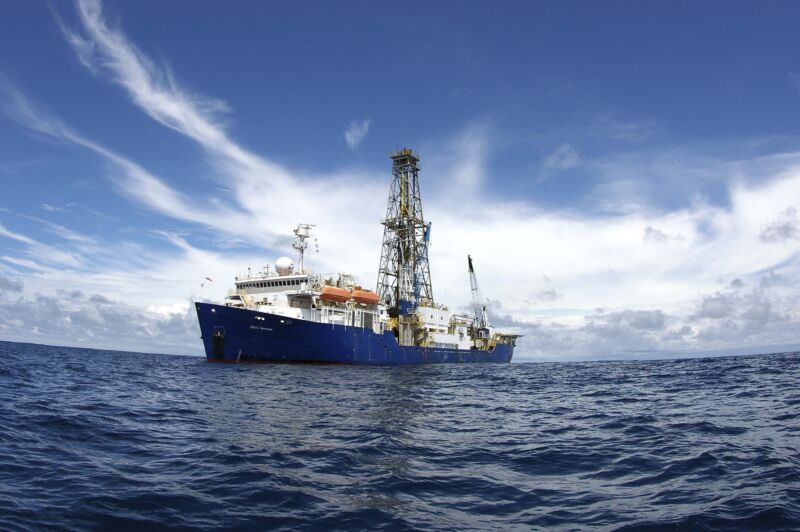
Enlarge / An oceangoing scientific drilling vessel may be needed to figure out how huge undersea aquifers formed.
One-quarter of the world’s population is currently water-stressed, using up almost their entire fresh water supply each year. The UN predicts that by 2030, this will climb to two-thirds of the population.
Freshwater is perhaps the world’s most essential resource, but climate change is enhancing its scarcity. An unexpected source may have the potential to provide some relief: offshore aquifers, giant undersea bodies of rock or sediment that hold and transport freshwater. But researchers don’t know how the water gets there, a question that needs to be resolved if we want to understand how to manage the water stored in them.
For decades, scientists have known about an aquifer off the US East Coast. It stretches from Martha’s Vineyard to New Jersey and holds almost as much water as two Lake Ontarios. Research presented at the American Geophysical Union conference in December attempted to explain where the water came from—a key step in finding out where other undersea aquifers lie hidden around the world.
As we discover and study more of them, offshore aquifers might become an unlikely resource for drinking water. Learning the water’s source can tell us if these freshwater reserves rebuild slowly over time or are a one-time-only emergency supply.
Reconstructing history
When ice sheets sat along the East Coast and the sea level was significantly lower than it is today, the coastline was around 100 kilometers further out to sea. Over time, freshwater filled small pockets in the open, sandy ground. Then, 10,000 years ago, the planet warmed, and sea levels rose, trapping the freshwater in the giant Continental Shelf Aquifer. But how that water came to be on the continental shelf in the first place is a mystery.
New Mexico Institute of Mining and Technology paleo-hydrogeologist Mark Person has been studying the aquifer since 1991. In the past three decades, he said, scientists’ understanding of the aquifer’s size, volume, and age has massively expanded. But they haven’t yet nailed down the water’s source, which could reveal where other submerged aquifers are hiding—if we learn the conditions that filled this one, we could look for other locations that had similar conditions.
“We can’t reenact Earth history,” Person said. Without the ability to conduct controlled experiments, scientists often resort to modeling to determine how geological structures formed millions of years ago. “It’s sort of like forensic workers looking at a crime scene,” he said.
Person developed three two-dimensional models of the offshore aquifer using seismic data and sediment and water samples from boreholes drilled onshore. Two models involved ice sheets melting; one did not.
Then, to corroborate the models, Person turned to isotopes—atoms with the same number of protons but different numbers of neutrons. Water mostly contains Oxygen-16, a lighter form of oxygen with two fewer neutrons than Oxygen-18.
Throughout the last million years, a cycle of planetary warming and cooling occurred every 100,000 years. During warming, the lighter 16O in the oceans evaporated into the atmosphere at a higher rate than the heavier 18O. During cooling, that lighter oxygen came down as snow, forming ice sheets with lower levels of 18O and leaving behind oceans with higher levels of 18O.
To determine if ice sheets played a role in forming the Continental Shelf Aquifer, Person explained, you have to look for water that is depleted in 18O—a sure sign that it came from ice sheets melting at their base. Person’s team used existing global isotope records from the shells of deep-ocean-dwelling animals near the aquifer. (The shells contain carbonate, an ion that includes oxygen pulled from the water).
Person then incorporated methods developed by a Columbia graduate student in 2019 that involve using electromagnetic imaging to finely map undersea aquifers. Since saltwater is more electrically conductive than freshwater, the boundaries between the two kinds of water are clear when electromagnetic pulses are sent through the seafloor: saltwater conducts the signal well, and freshwater doesn’t. What results looks sort of like a heat map, showing regions where fresh and saltwater are concentrated.
Person compared the electromagnetic and isotope data with his models to see which historical scenarios (ice or no ice) were statistically likely to form an aquifer that matched all the data. His results, which are in the review stage with the Geological Society of America Bulletin, suggest it’s very likely that ice sheets played a role in forming the aquifer.
“There’s a lot of uncertainty,” Person said, but “it’s the best thing we have going.”