Ancient desert mega-structures were planned using carved maps to scale
On the ninth day of Christmas —
“This calls for the representation of space in a way not seen at this time.”

There’s rarely time to write about every cool science-y story that comes our way. So this year, we’re once again running a special Twelve Days of Christmas series of posts, highlighting one science story that fell through the cracks in 2020, each day from December 25 through January 5. Today: Archaeologists found two stone engravings in Jordan and Saudi Arabia that may represent the oldest architectural plans for desert kites.
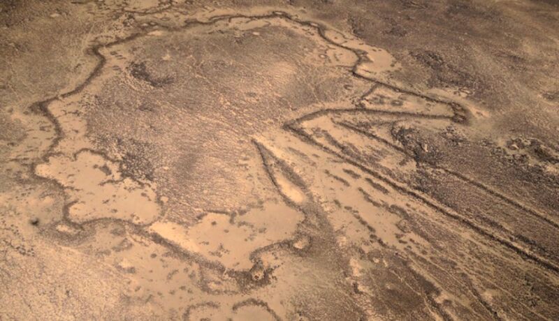
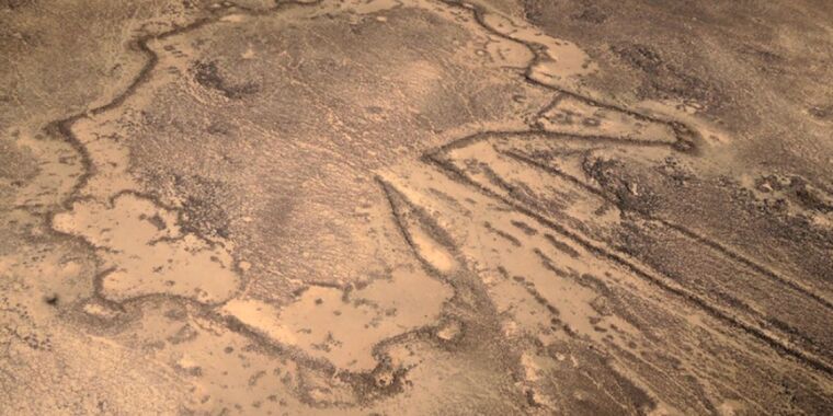
During the 1920s, aerial photographs revealed the presence of large kite-shaped stone wall mega-structures in deserts in Asia and the Middle East that most archaeologists believe were used to herd and trap wild animals. More than 6,000 of these “desert kites” have been identified as of 2018, although very few have been excavated. Archaeologists found two stone engravings—one in Jordan, the other in Saudi Arabia—that they believe represent the oldest architectural plans for these desert kites, according to a May paper published in the journal PLoS ONE.
“The discovery of these very ancient representations highlights the question of the methods used by kite builders,” the authors wrote. “Kites are large material structures that could not be designed without what we call today planning. The ability to transpose large spaces into a small two-dimensional surface represents a milestone in intelligent behavior. Such structures are visible as a whole only from the air, yet this calls for the representation of space in a way not seen at this time.”
The eight kites at Jibal al-Khashabiyeh in Jordan were discovered in 2013, and archaeologists began excavations in 2015 and 2016. Looters had targeted one such site, so archaeologists conducted a rescue excavation, noting numerous carved cigar-shaped limestones scattered around the surface. One such stone had a very well-preserved engraving. The engraving’s shape is characteristic of the two desert kites at Jibal al-Khashabiyeh that are nearest to where the engraved rock was found, and the authors estimate the age of the engraving to be about 7,000 years old.
The engraving was likely carved with a lithic tool, employing a combination of fine incisions to mark out the contours of the kite and pecking. The kite-shaped engraving comprises two primary converging curved lines, which the researchers interpreted as representing driving lines. These lead to a carved star-shaped enclosure with eight circular cup marks at the circumference representing pit traps. The characteristics are typical of desert kite structures in southeastern Jordanian kites. The archaeologists remain puzzled by a zigzagging chevron pattern running perpendicular to the corridor, but hypothesize that it might represent a slope break feature.
The kites at Jebel az-Zilliyat in Saudi Arabia were discovered in 2014 and excavated the following year. The engraved sandstone boulder in this case—found during rock art surveys—was studied in situ and dated to around 8,000 years ago. The carving was likely made by pecking the contours using a lithic tool or a handpick. While the eastern engraving on the boulder was very readable, the western one had been badly damaged by erosion. Both feature the same two short, widely spaced driving lines that gradually converge into a star-shaped enclosed surface surrounded by six cup marks (pit traps). Once again, the authors noted clear similarities between the engraved representations of kites on the boulder and actual desert kite shapes nearby.
There have been other maps, plans, or representations in human history, per the authors, such as Upper Paleolithic engravings in Europe that seem to be maps of hunting strategies, or a mural in Turkey from about 6600 BCE that seems to depict a village. There is even a reed-bundle boat found in Kuwait, dated 5000 BCE, that is considered to be the oldest three-dimensional model of a large-scale object. However, the two engravings found in Jordan and Saudi Arabia are unique because they were done to scale: approximately 1: 425 and 1: 175, respectively.
As for why the engravings were made, the authors considered three hypotheses: it was a detailed kite construction plan; it was a plan for preparing hunting activities; or it could be more symbolic—a means of passing on knowledge of the pace and/or its function. Of those, the authors consider the second to be the most credible, given the careful graphical representation of the functional elements of the trap, but cannot rule out the other two possibilities.
“A map would most probably be used here as a means of communication (almost like an ancestral way of writing) and would enable the collective interaction required for the smooth running of hunting operations,” the authors concluded. “These two major innovations, i.e., building what would become the largest structures in human history at that time and making cartographic representations to scale, are closely linked by a common point: mastering the three-dimensional perception of a space, and translating it into an inscribed form of communication.”
PLoS ONE, 2023. DOI: 10.1371/journal.pone.0277927 (About DOIs).
Ancient desert mega-structures were planned using carved maps to scale Read More »
